English
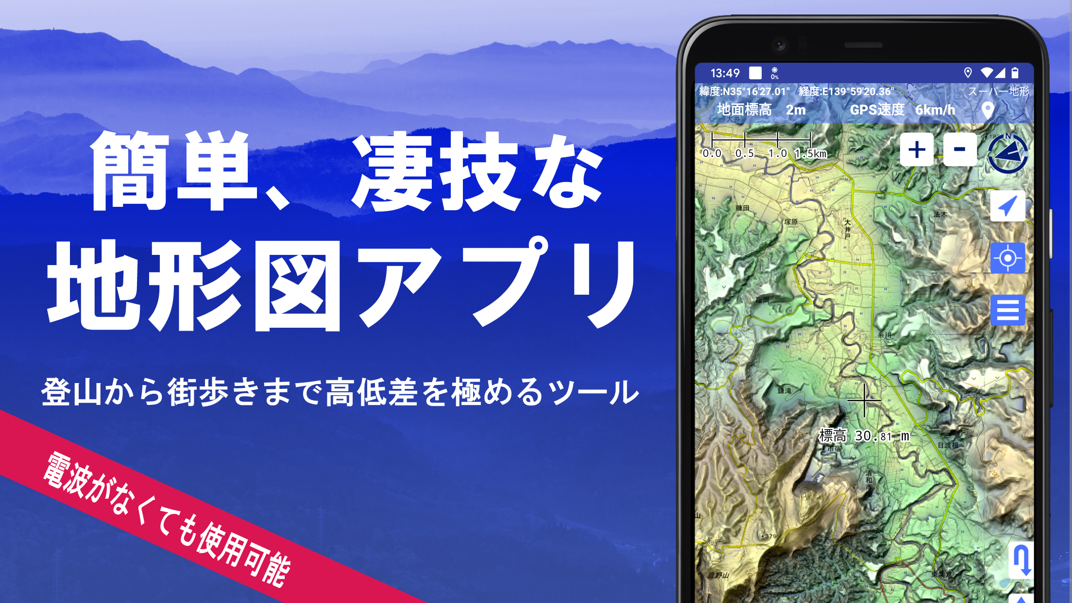
スーパー地形 (Super Terrain) is an innovative and interactive mapping application that allows users to explore detailed topographic maps and terrain data of various locations. This app provides highly accurate elevation data, making it an ideal tool for outdoor enthusiasts, hikers, and adventurers who want to gain a deeper understanding of the land they are exploring. With features like 3D visualization, customizable maps, and offline functionality, スーパー地形 helps users navigate and plan their activities with precision. Whether you're preparing for a hiking trip, studying geographical features, or simply exploring different regions, this app provides a comprehensive solution for anyone interested in terrain mapping.
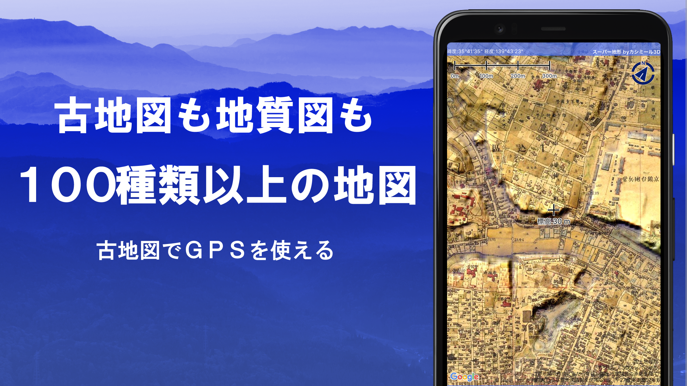
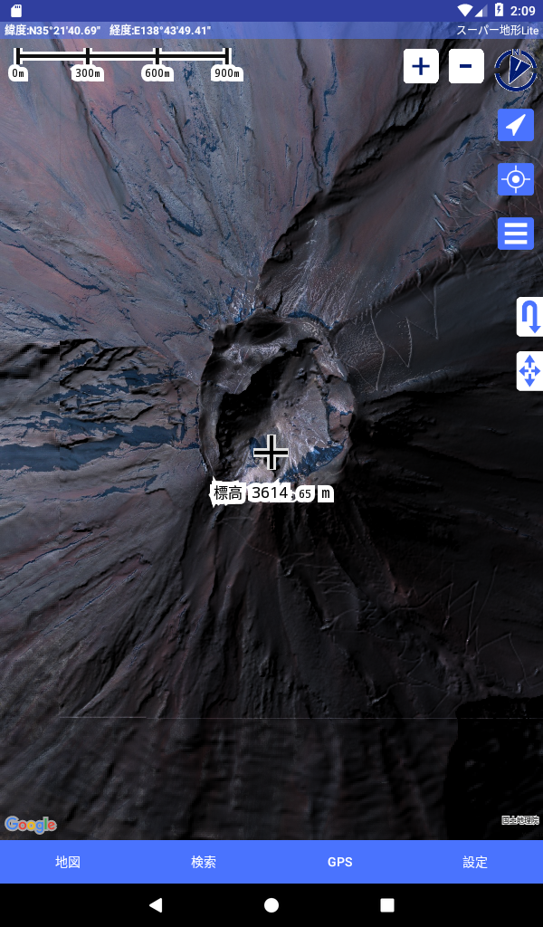
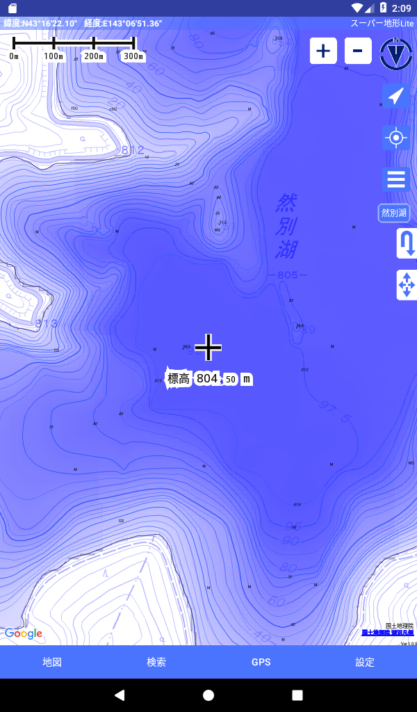
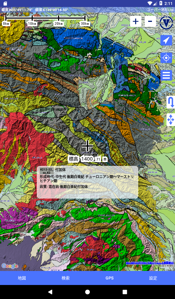
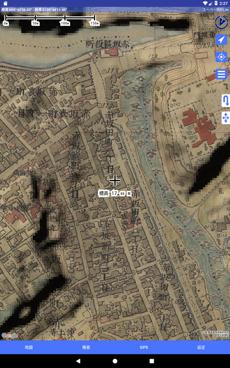
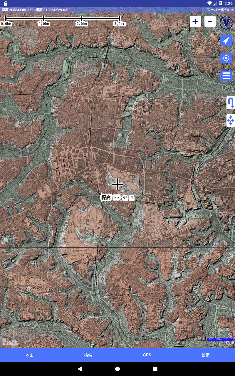
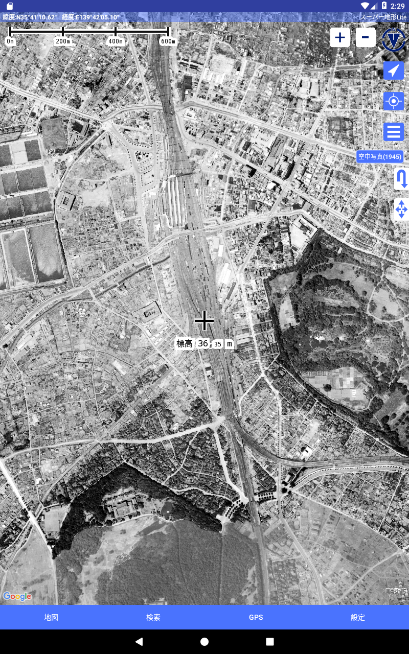
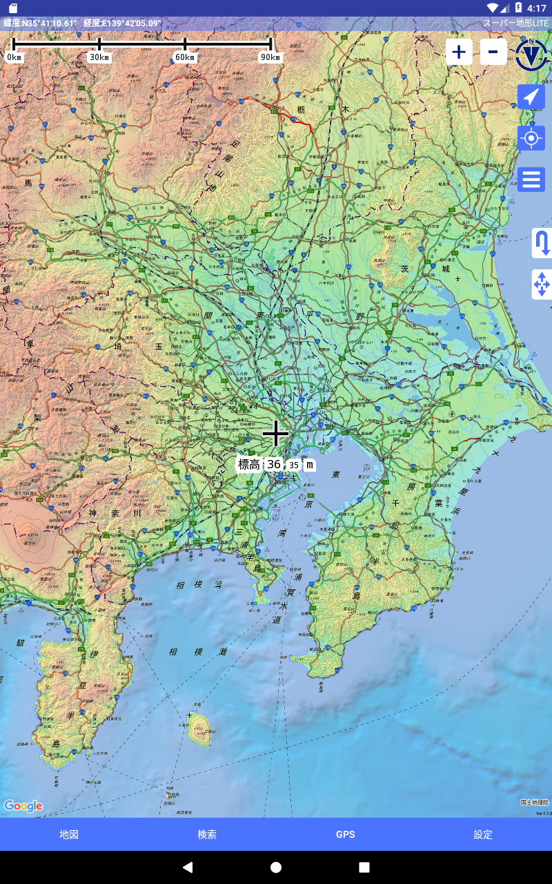
- Detailed Topographic Maps: Access a variety of topographic maps with high precision, showing elevation data and natural terrain features like mountains, valleys, and rivers.
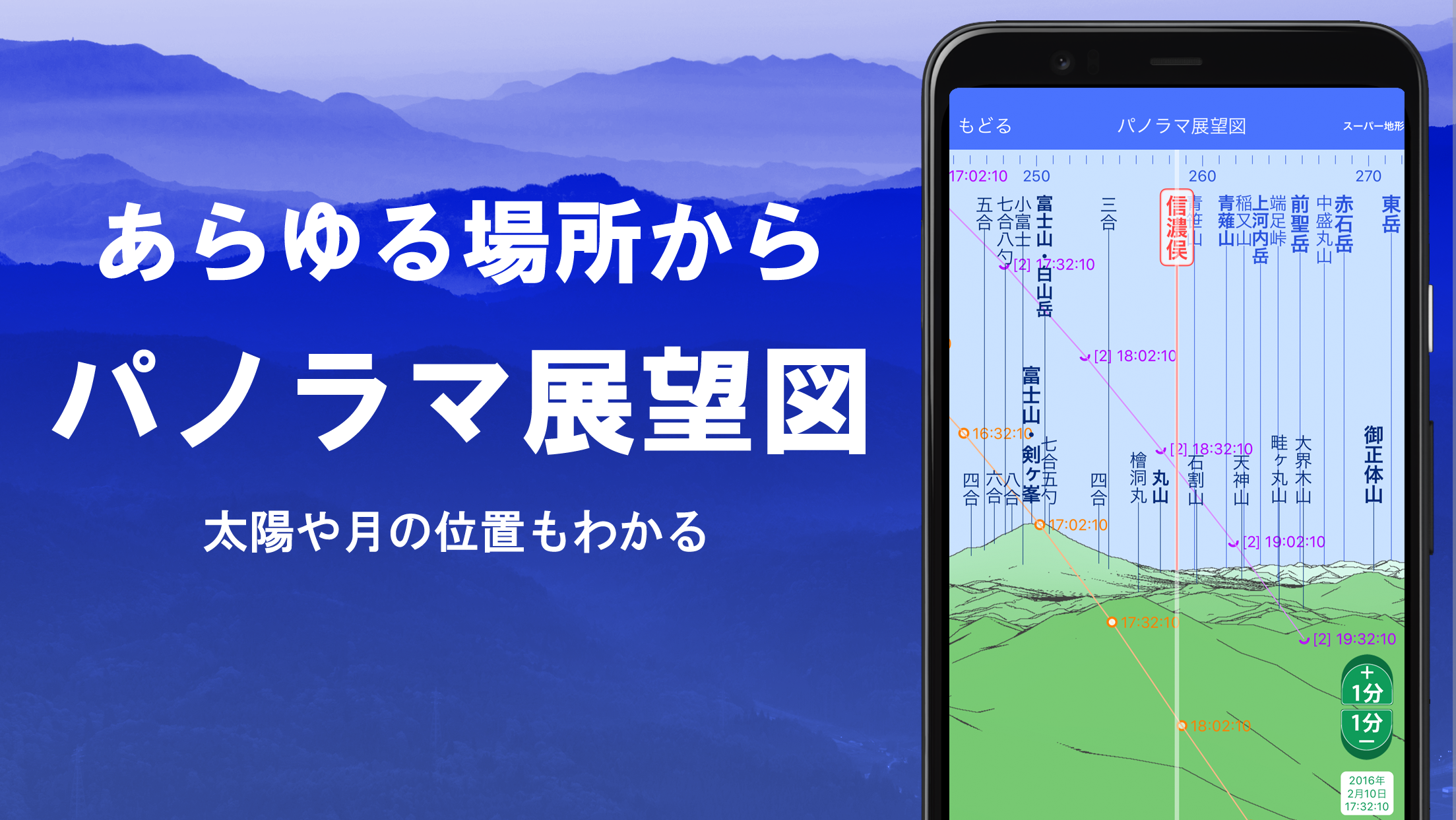
- 3D Terrain Visualization: Explore terrain data in a 3D view, giving you a realistic perspective of landscapes and allowing you to better understand elevation changes and natural features.
- Customizable Layers: Personalize your map by adding or removing different map layers, such as hiking trails, roads, and points of interest, to suit your specific needs.
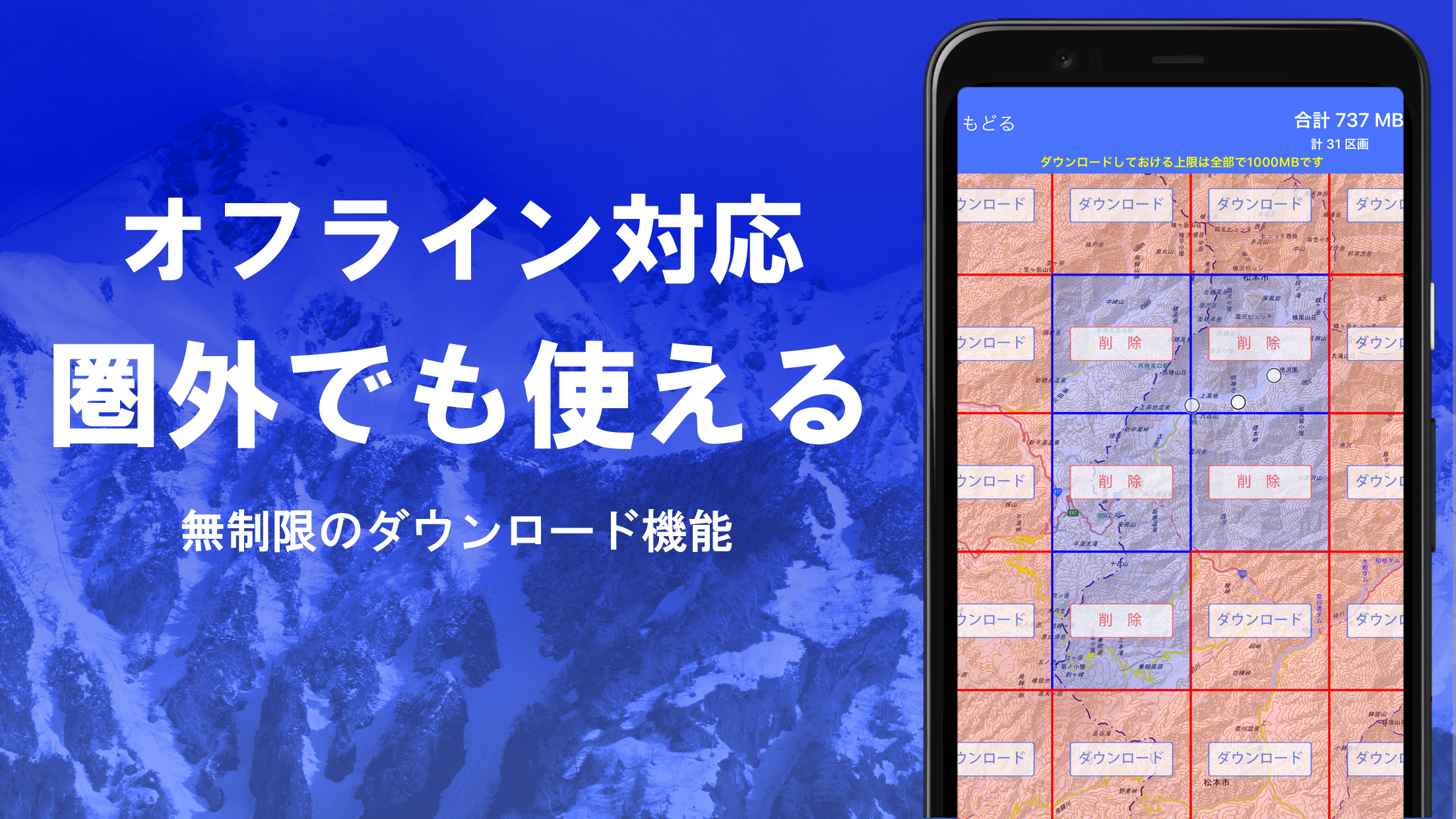
- Offline Functionality: Download maps for offline use, so you can access crucial terrain data even in remote areas without an internet connection.
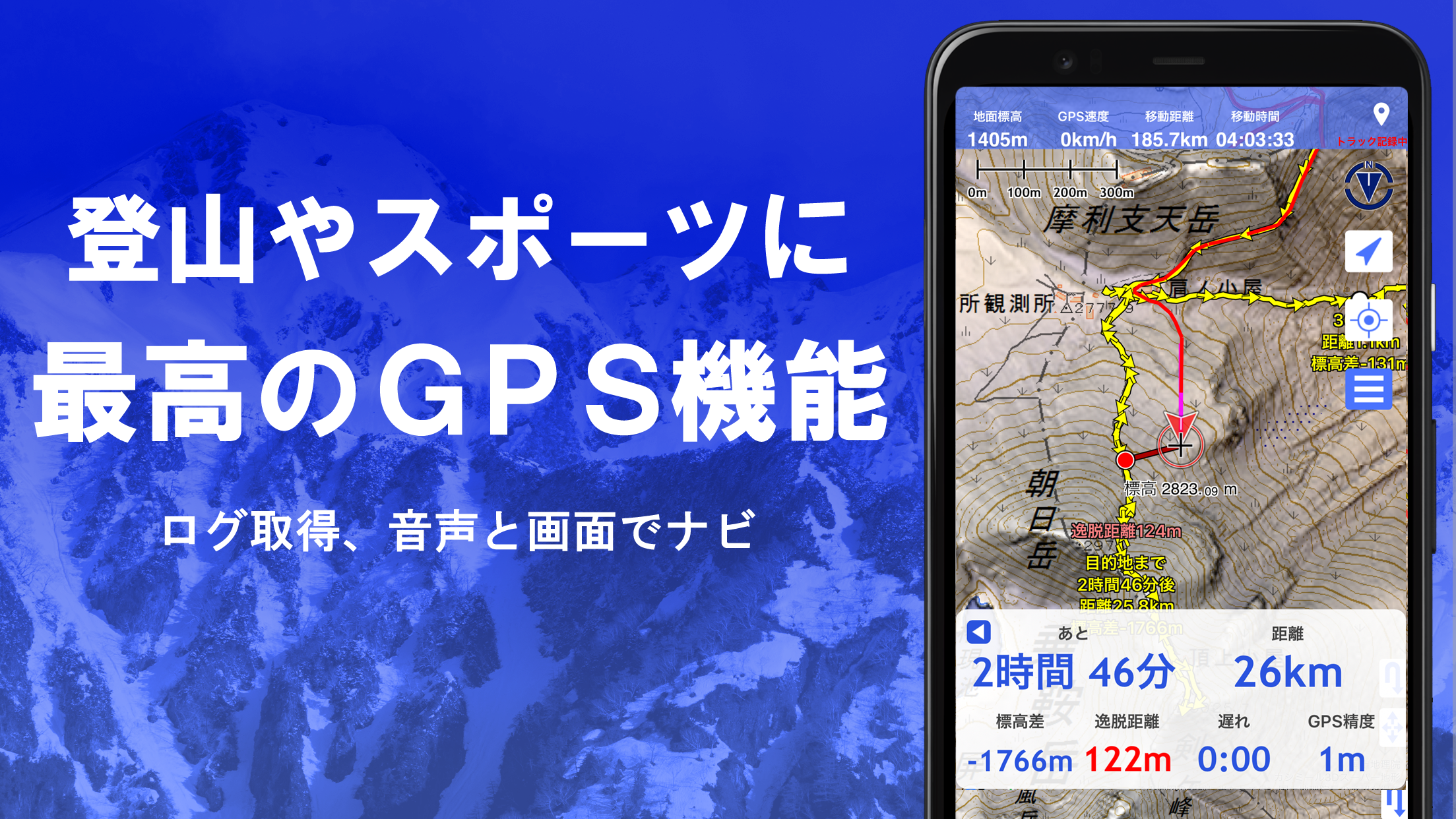
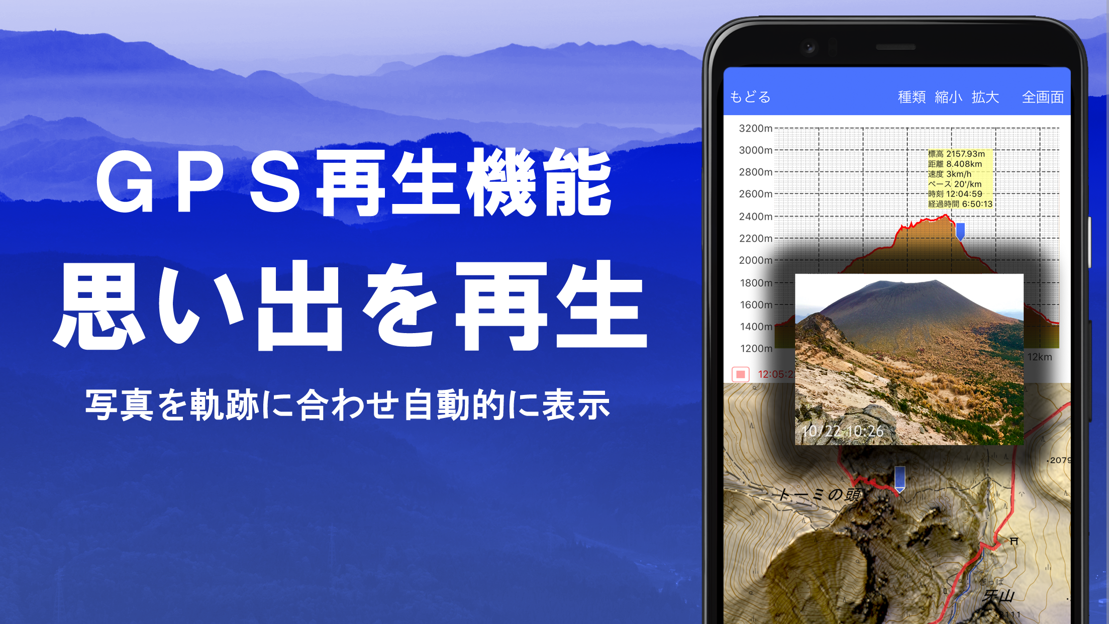
- GPS Integration: Use GPS tracking to view your current location on the map and plan your route accordingly, whether you're exploring a new area or revisiting a familiar location.
- Familiarize Yourself with Layers: Take the time to learn about the different map layers and features available in the app. Adjusting layers for hiking trails, terrain types, or routes can help you navigate better.
- Plan Routes in Advance: Use the app’s 3D terrain visualization to plan your route and anticipate difficult areas, helping you prepare for challenging hikes or trips.
- Utilize Offline Maps: Before heading into areas with no signal, be sure to download relevant maps to avoid any interruptions when using the app outdoors.
- Set Waypoints: Mark important locations, landmarks, or spots you want to visit with waypoints. This helps you keep track of your route and ensures you don’t miss key points along the way.
- Check Elevation Changes: Pay attention to elevation markers on the map, especially when planning a hike or outdoor activity. Understanding the terrain’s elevation can help you assess the difficulty level of your journey.
スーパー地形 (Super Terrain) is an essential tool for outdoor enthusiasts, travelers, and anyone interested in terrain mapping. With its detailed topographic maps, 3D visualizations, and offline features, the app offers a unique and practical way to explore the natural world. Whether you’re preparing for a hiking adventure, studying geography, or simply curious about the terrain around you, スーパー地形 provides the tools to understand and navigate landscapes with ease. For anyone who values accurate and interactive terrain data, this app is an invaluable resource for making informed decisions and enhancing outdoor experiences.


Suggestify
Size:55.00M LifestylemyEasyBud
Size:67.00M LifestyleBlouse For Skirt Gallery
Size:29.70M LifestyleGratitudes Journal
Size:9.40M LifestyleSunrise Church Puyallup
Size:35.00M LifestyleBloodLinks
Size:35.00M LifestyleZany's
Size:97.90M LifestyleChristmas Office Decor Idea
Size:27.30M LifestyleMeram Restaurant
Size:12.90M LifestyleFinger Henna Idea
Size:31.00M LifestyleRobin Knows
Size:65.00M LifestyleAmanos
Size:102.00M LifestyleApril 2024 Clash of Clans Update: Unveiling a Fresh Companion, Enhanced Levels, Chat Tagging, and Be
2024-04-16Arrival of Genshin Impact 4.6 Update: 'Embers of Two Realms, Twilight of Crimson'
2024-04-16V2.2 of the Farlight 84 update introduces an overhauled Season structure, fresh in-game currency, an
2024-04-16Monster Never Cry is now accessible on both Android and iOS mobile devices.
2024-04-18PUBG Mobile Teams Up with Bentley Motors: Luxury Cars, Exclusive Collectibles, and Beyond
2024-04-18March 2024 Free Redemption Codes for Honkai: Star Rail
2024-04-18