English
Karttaselain brings Finland's most authoritative cartography into your pocket: free topographic maps, aerial photos, urban maps and a GPS-enabled terrain and marine viewer that works offline. Designed for people who spend time outdoors or work with land and water data, Karttaselain combines National Land Survey material, basic depth charts and property boundaries with device GPS tracking, GPX import/export and map feedback tools. The app suits hikers, boaters and anyone needing reliable location data, while a paid Plus tier unlocks more detailed marine and property data and advanced planning and sync capabilities.
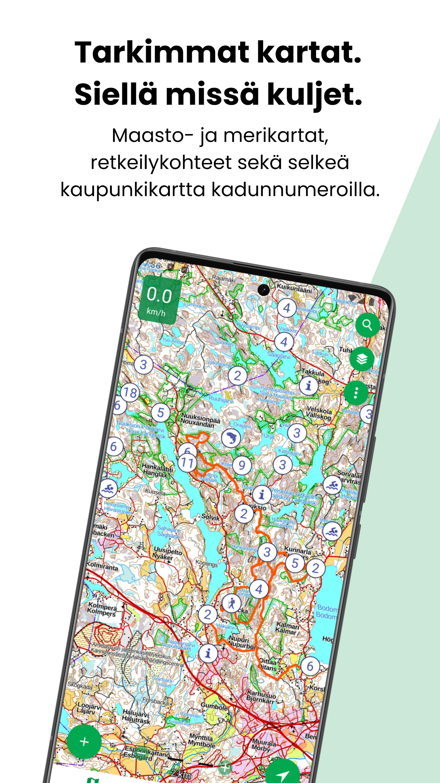
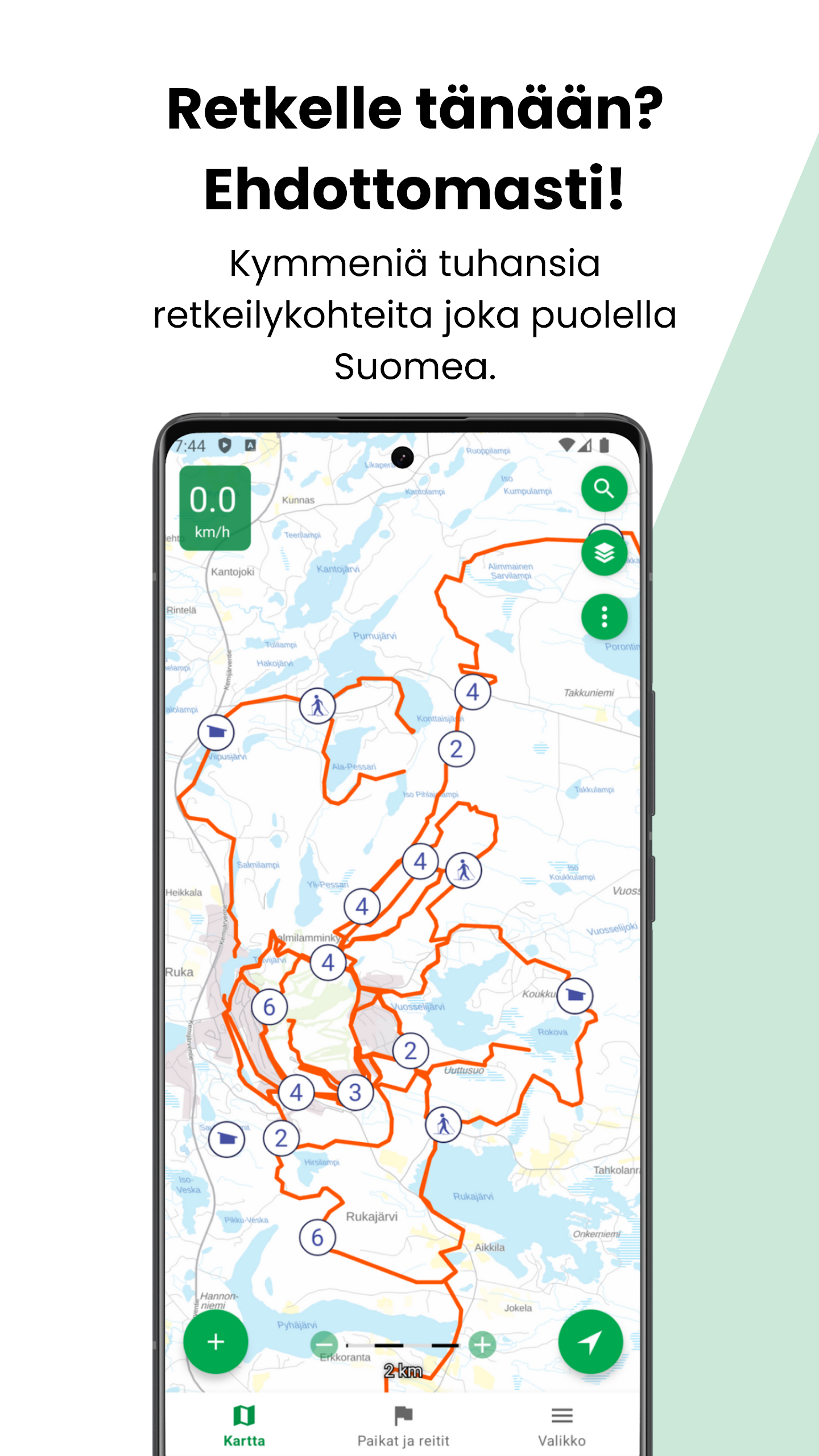
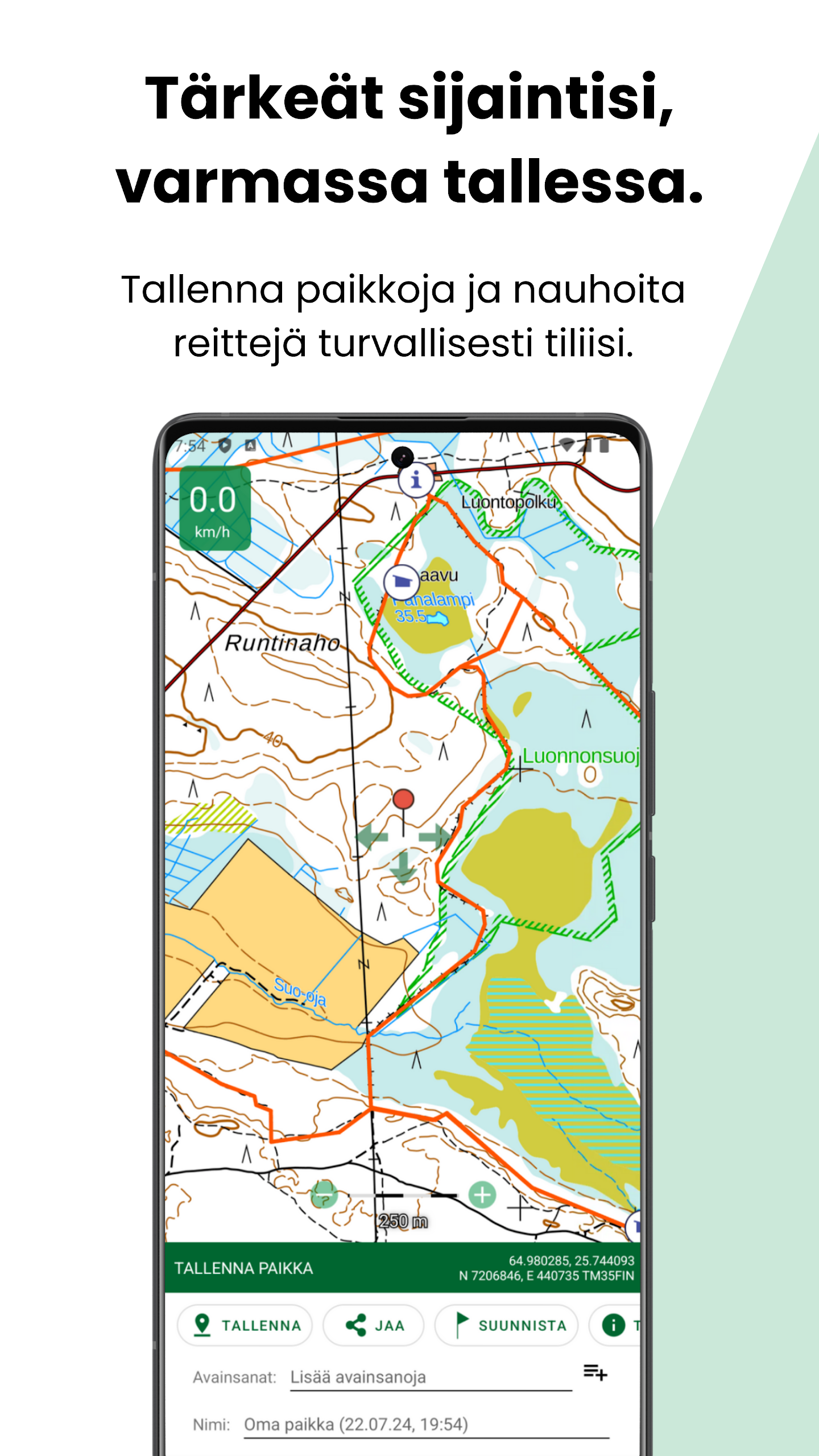
The core of Karttaselain is a set of up-to-date topographic maps from the National Land Survey, paired with aerial imagery that covers the whole country and street-level urban maps showing names and numbers. The app provides accurate GPS positioning, location tracking and speed display when your device has a receiver, plus map rotation, compass and a directional line with distance to a selected target where a digital compass is available. You can save and manage places and routes, import and export GPX files, and open locations from other apps. A built-in map feedback tool lets users suggest corrections to the underlying maps.
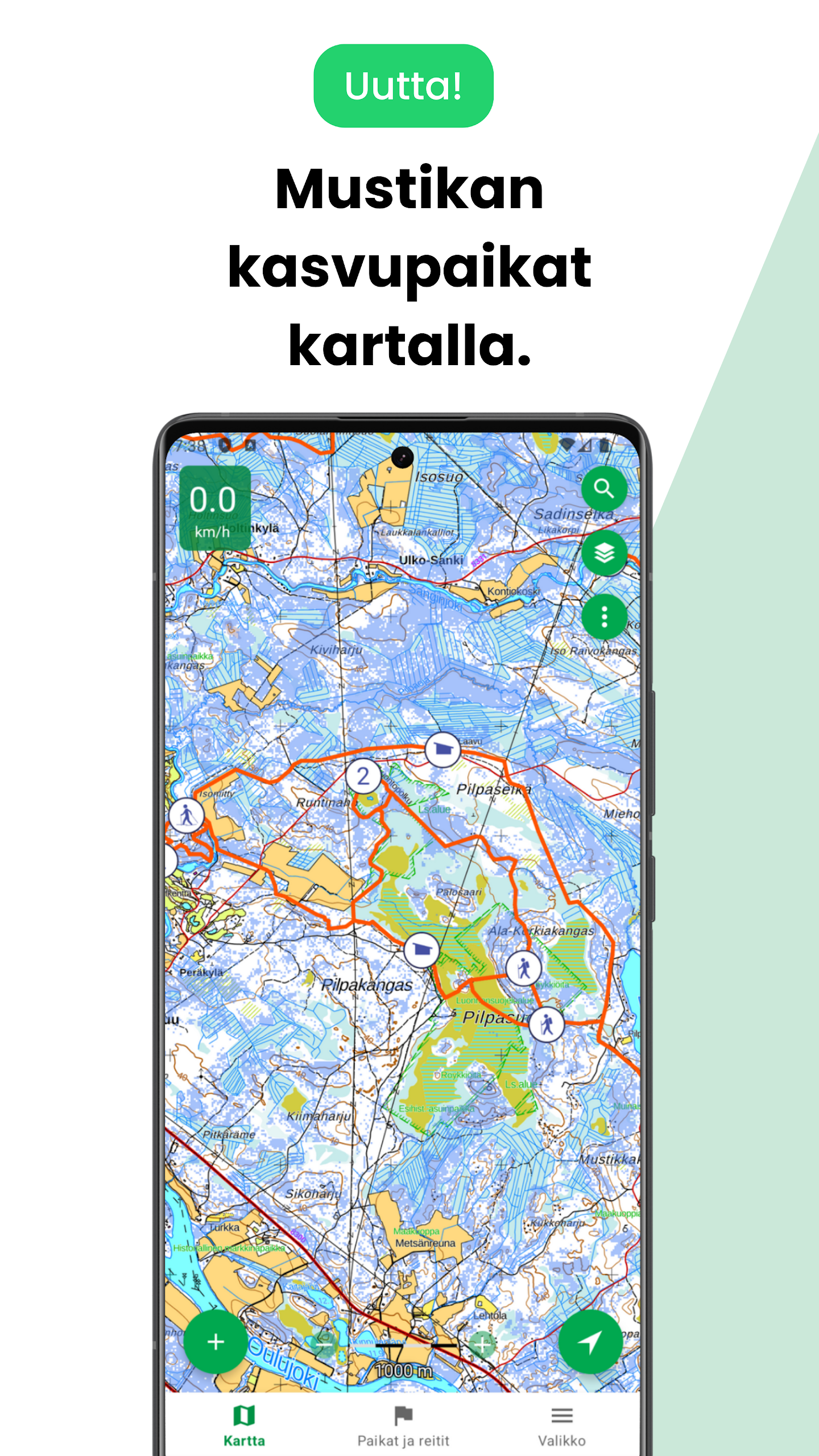
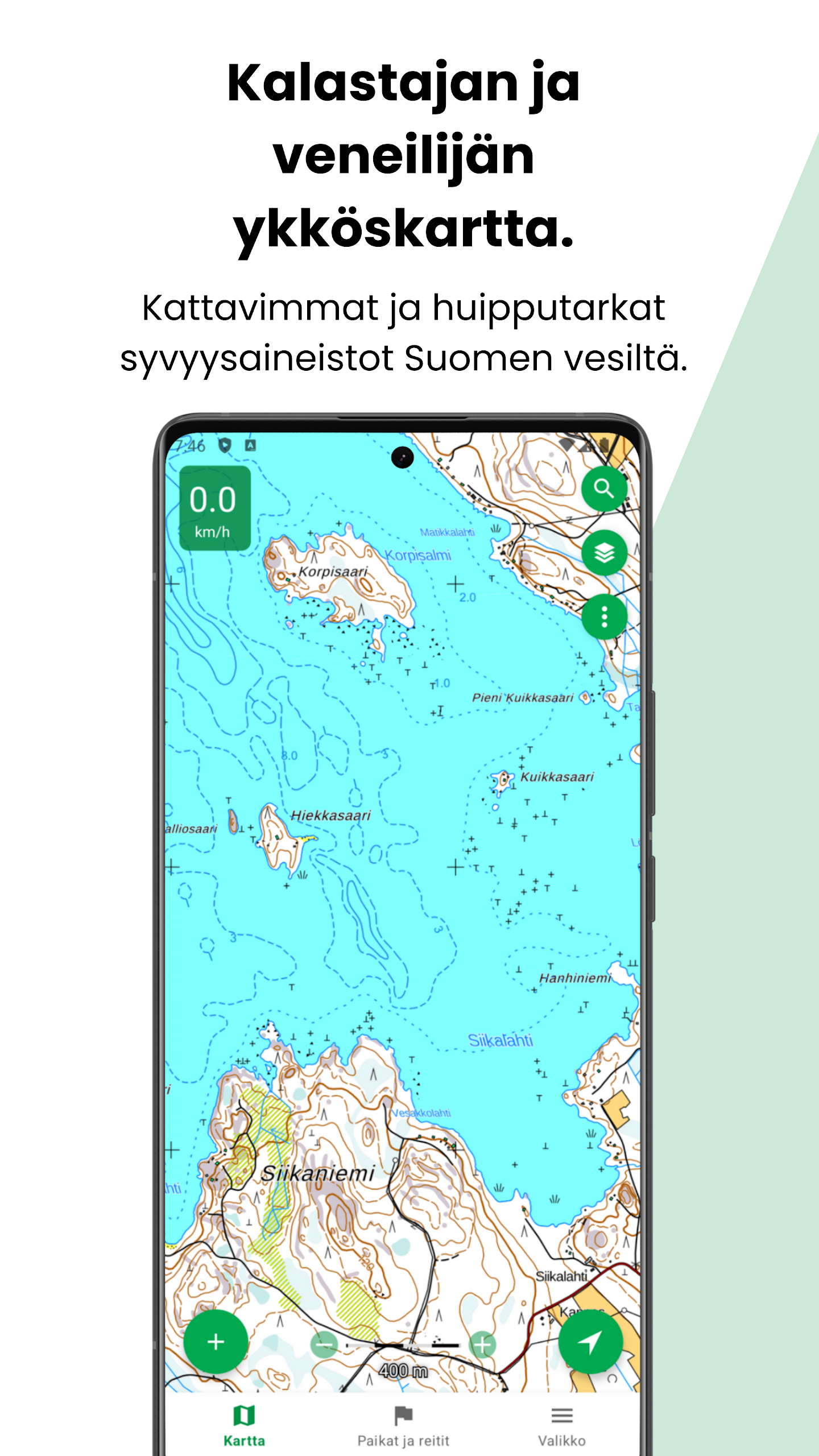
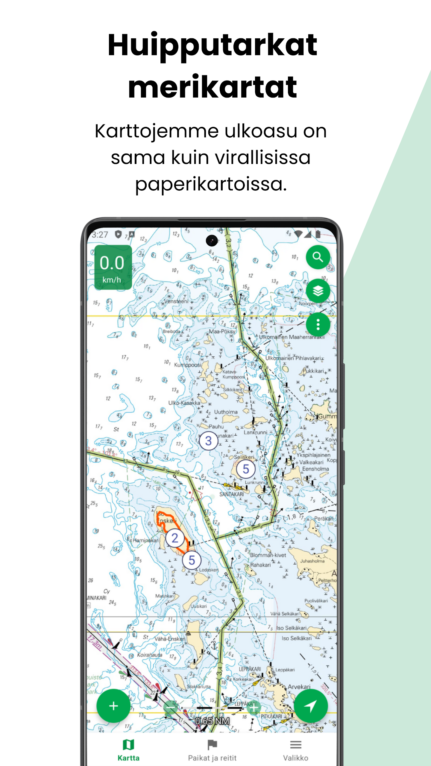
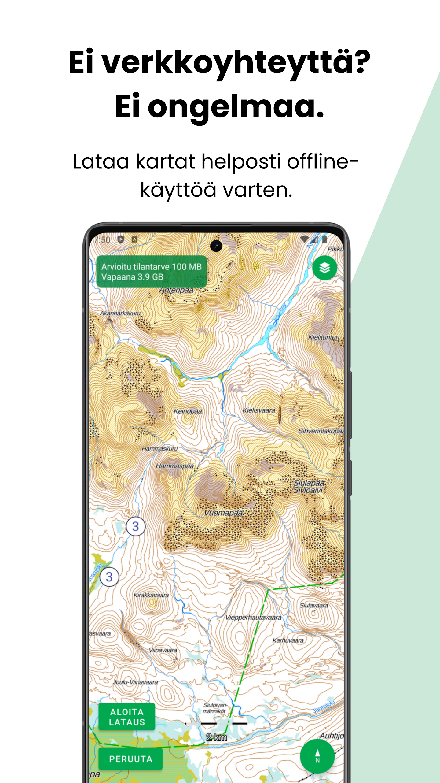
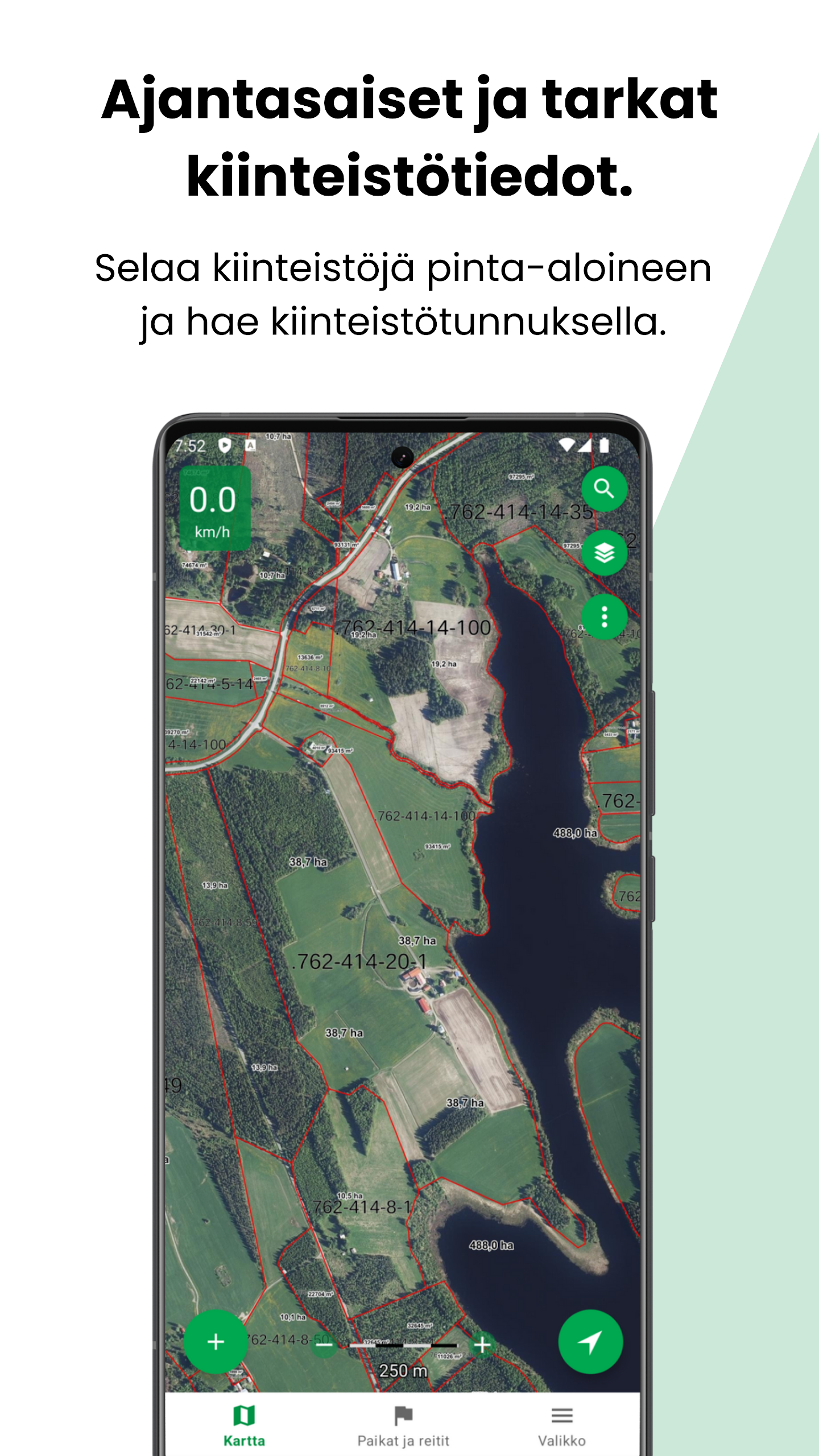
Karttaselain's Plus subscription builds on the free base with specialised data and cloud features: the enhanced depth chart delivers detailed contours and readings for boating and fishing; upgraded marine chart data from official sources; continuously updated property boundaries and searchable property information; and new map layers such as slope shading and forest orthophotos. Plus also enables secure waypoint and route storage tied to your account, automatic synchronization between web and mobile versions, route planning and area calculations, convenient offline map downloads, and support for external tracking devices including dog and personal trackers. A 14-day free trial is offered, after which the subscription continues at the posted rates (€9.99 for two months or €39.99 for twelve months) and can be used on up to four devices per user, with multi-user business licenses available.
The interface focuses on clarity and practical map controls: the map menu exposes layers and data choices, and newly added slope shading helps visualise terrain shapes while forest orthophotos add contextual detail for route selection. GPX import/export and keyword-managed saved places make it easy to organize routes, and offline downloads mean the app remains useful where mobile coverage is sparse. Users who enable Plus benefit from seamless sync between devices and persistent cloud storage for waypoints and tracks; the app is developed with community input and supported by customer service for troubleshooting.
If you need dependable topographic and marine maps with strong offline capability and advanced planning tools, Karttaselain is a pragmatic choice. The combination of authoritative map sources, GPS utilities, GPX support and optional Plus features like detailed depth data and synchronized cloud storage makes it suitable for outdoor enthusiasts and professional users alike. Try the trial to explore the additional layers and routing tools and see how Karttaselain fits your mapping needs.

Suggestify
Size:55.00M LifestylemyEasyBud
Size:67.00M LifestyleBlouse For Skirt Gallery
Size:29.70M LifestyleGratitudes Journal
Size:9.40M LifestyleSunrise Church Puyallup
Size:35.00M LifestyleBloodLinks
Size:35.00M LifestyleZany's
Size:97.90M LifestyleChristmas Office Decor Idea
Size:27.30M LifestyleMeram Restaurant
Size:12.90M LifestyleFinger Henna Idea
Size:31.00M LifestyleRobin Knows
Size:65.00M LifestyleAmanos
Size:102.00M LifestyleApril 2024 Clash of Clans Update: Unveiling a Fresh Companion, Enhanced Levels, Chat Tagging, and Be
2024-04-16Arrival of Genshin Impact 4.6 Update: 'Embers of Two Realms, Twilight of Crimson'
2024-04-16V2.2 of the Farlight 84 update introduces an overhauled Season structure, fresh in-game currency, an
2024-04-16Monster Never Cry is now accessible on both Android and iOS mobile devices.
2024-04-18PUBG Mobile Teams Up with Bentley Motors: Luxury Cars, Exclusive Collectibles, and Beyond
2024-04-18March 2024 Free Redemption Codes for Honkai: Star Rail
2024-04-18